When the Water Pulls Back
Cover image: an editorial composition generated with AI from a historical photograph. It is not a further documentary view of the submerged settlement.
In the mountains of Puerto Rico, a drought can uncover more than ground.
There is a church in Utuado that spends most of its time under water.
It sits in Lago Caonillas, a reservoir ringed by mountains. When a drought comes and the water drops far enough, the ruins of the church start to appear. The interesting part is that it was there before the lake was.
And it wasn't the only thing.
Before the dam was built, that valley was lived in. There were houses, farms, shops, a school and a church. It was a community with its own history, its own roads and its own routines, and today barely a trace of it is visible.
In Habitantes de la Memoria: Utuado, a publication devoted to recovering the municipality's history, I found accounts of the people who lived there.
One of them was Ángel Luis Beauchamp, who remembered the two-storey house he grew up in. His family used part of it to store tobacco, coffee and other crops.
That detail stayed with me. It is easy to read that a dam flooded a valley and stop at the historical fact. But picturing a house where the harvest was kept makes it easier to understand what losing that place meant.
Through the 1940s, Puerto Rico was building out its hydroelectric infrastructure. The Caonillas dam was part of that effort, and on 28 June 1948 the reservoir began to fill.
For the families living in the valley, the construction meant leaving their homes and moving elsewhere. The land they had farmed, the roads they had walked and much of their community ended up under water.
The dam contributed to the country's electrical infrastructure, but that transformation also had consequences for the people who lived there.
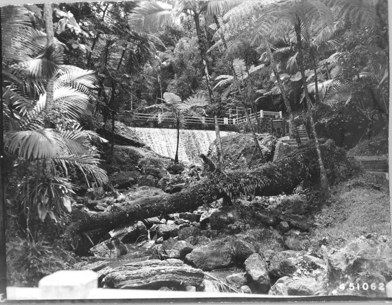 View of the area below the Caonillas dam, Puerto Rico (1947). Harry S. Truman Library & Museum, photograph 2009-2999. Public domain according to the archive's record. See the original.
The church went under along with the rest of that landscape. Decades later, during droughts, its ruins are partly exposed again.
What interests me about Caonillas is not only the image of a church surfacing in the middle of a lake. It is thinking about everything that was around it and that we can no longer see.
Because when we look at a map, we tend to assume places have always been more or less where they are now. But the geography we know is the result of natural and human changes that are still happening.
At Caonillas the land did not disappear. It was covered by water. And although the landscape changed, we can still reconstruct part of its history thanks to the testimonies, the documents and the photographs that survived.
That curiosity is where The Ground Beneath Us came from — a series about places that disappear, others that rise, and the stories of the people who lived through those changes.
The next instalment takes us to La Palma, in the Canary Islands. There, in 2021, a volcanic eruption destroyed homes, roads and land. But when the lava reached the ocean, it also made new ground.
At Caonillas, water covered a place that had been lived in. At La Palma, an eruption reshaped the coast and added land where there had been sea.
Two very different ways of reminding us that the map is never finished.
Next instalment: La Palma — the land that appeared.
What survived Caonillas is whatever somebody bothered to keep, which is the whole argument for leaving a time capsule carved in stone.
A valley is lost when nobody holds on to its paperwork, the same way a personal archive is lost when it lives inside a service you don't control.
The island also runs on stories everyone repeats with no document behind them, like the one about the Target stores.
Sources and photo credits
- Héctor Vélez Arocho, "El Lago Caonillas: un pueblo bajo agua," in Habitantes de la Memoria, ed. Sandra A. Enríquez Seiders, Universidad de Puerto Rico en Utuado, November 2003, revised October 2008, pp. 53–54. Includes Ángel Luis Beauchamp's testimony and mentions the Capilla Sagrado Corazón. Consult source
- U.S. Geological Survey, Sedimentation Survey of Lago Caonillas, Puerto Rico, February 1995, p. 2. Confirms the gates were closed on 28 June 1948. Consult source
- Beto y Dylia historical archive, "Fotos de Archivo, Página 3." Identifies old photographs of the Capilla Sagrado Corazón; authorship and reproduction licence unverified. Consult source
- Beto y Dylia historical archive, "Fotos de Archivo, Página 2." Photographs of the dam's construction, attributed to 1946 and 1948; reproduction licence unverified. Consult source
- Forest Service / Harry S. Truman Library & Museum, photograph "View of the Area Below Caonillas Dam in Puerto Rico," 1947, no. 2009-2999. Catalogued as public domain; the description does not say it shows the construction. Consult source
- Forest Service / Harry S. Truman Library & Museum, "Puerto Rican Family standing above the Caonillas Dam," 1947, no. 2009-2998. Catalogued as public domain; it is not the same as a photograph of the community before the flooding. Consult source
📬 Enjoyed this article?
Subscribe for the stuff that doesn't make it into Alcolandia — half-finished ideas, what I'm reading and listening to, behind-the-scenes notes, and the occasional rabbit hole. No spam, just things worth your time.